The name Cam Lâm has been formed since July 1951. After the national liberation day, October 29, 1975, Khanh Hoa was merged with Phu Yen to become Phu Khanh Province. At this time, Cam Lam was merged with Cam Ranh Town to become Cam Ranh District. On June 30, 1989, Khanh Hoa Province was re-established, Cam Ranh district was upgraded into Cam Ranh Town on July 7, 2000,.
On April 11, 2007, the Government issued Decree No. 65 adjusting the administrative boundaries of Cam Ranh Town and Dien Khanh district to establish Cam Lam district. Accordingly, Cam Lam district was established with 1 town and 13 communes with an area of 546.59km²; population by 2020 of 110,650.
Although Cam Lam District is newly-estimably in 2007, this is an ancient land, inhabited by humans for a long time. Through excavations and archaeological surveys at the archaeological sites of Van Tu Dong, Go Rung, Trang Chay, Tan An ... of the Institute of Archeology of Vietnam and the Museum of Khanh Hoa Province, the archaeological sites dated back to about 3,000 - 3,500 years ago.
Currently, the district's average economic growth rate is 12.41%/year; the economic structure has shifted in a positive direction, gradually increasing the proportion of tourism, service and trade from 9% (in 2007) to 29% in 2022. The proportion of industry and construction has decreased from 77.9% to 64.9%; agriculture, forestry and fishery down from 13.1% to 6.7%. The total annual budget revenue increased by an average of 21.1%. By 2022, the district budget revenue rose by 16.7 times compared to 2007.
The Resolution 09 of the Politburo on construction and development of Khanh Hoa Province by 2030, with a vision to 2045 has oriented Cam Lam District as a modern, ecological and airport urban area.
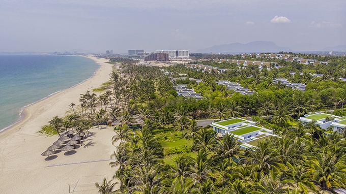 |
| Bai Dai Beach. |
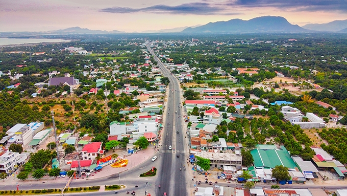 |
| A corner of Cam Lam. |


Thông tin bạn đọc
Đóng Lưu thông tin