The Exhibition of antique maps themed “The presence of
Many visitors showed genuine interest in the display of antique maps. Nguyen Duy Dung (
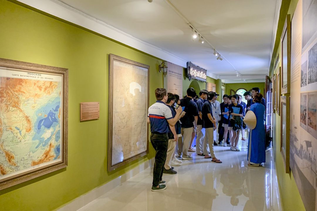 |
| A tour guide introduces the antique map exhibition. |
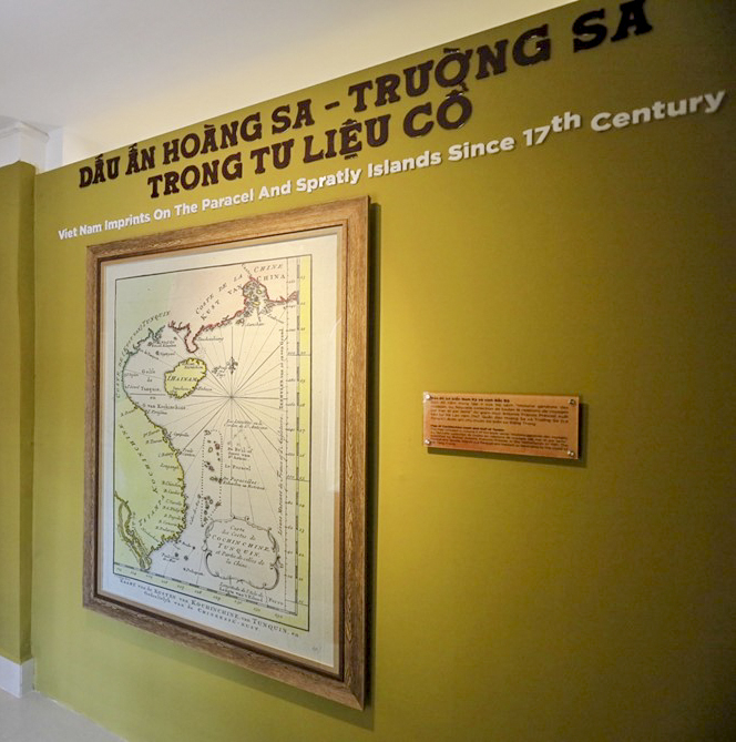
The antique map exhibition features 18 out of 414 maps restored and arranged according to 3 main themes, namely Vietnam imprints on the Paracel and Spratly Islands in ancient documents; The exercise of marine research over Vietnam’s sovereignty waters, the Paracel and
Visitors can learn about original maps published based on data from the "Mission Hydrographique en Indochine" survey trips of the French Navy and documents from survey trips (1925 - 1939) of De Lanessan of the Indochina Institute of Oceanography (presently as the
In addition, the exhibition also has maps describing the continental shelf and islands in Vietnam's waters, and currents in the East Sea continental shelf from the Gulf of Tonkin to the Gulf of Thailand, the Paracel and Spratly Islands to serve fishing and other maritime activities such as warning of dangerous waters for fishing on the Spratly Islands (1925-1931); location of TFS radio station, lighthouse and hydrometeorological station in the Paracel Islands (1938-1939); description of coral reefs on the Spratly Islands (1938) and so on.
 |
| Photos at the antique map exhibition. |
According to Associate Professor - Ph.D. Dao Viet Ha, Director of the Institute of Oceanography, in pursuit of marine scientific research, the Institute of Oceanography has preserved as many as 740 maritime maps, ocean depth maps, East Sea maps, Vietnam maps, Vietnam geological maps, etc.
One of the oldest map was produced in 1831. Most of the maps dating back to before 1975 were produced by the French Navy and others by the American Navy. To preserve historical scientific documents, the Vietnam Academy of Science and Technology assigned the
According to Ph.D. Truong Si Hai Trinh, Chief of the Department of Communication and Environmental Education,
V.L
Translated by N.T


Thông tin bạn đọc
Đóng Lưu thông tin