According to the Khanh Hoa Provincial Hydrometeorological Station, at 1:00 p.m. on November 28, Storm Koto was located about 190 km northwest of Song Tu Tay Island. Maximum sustained winds near the center reached level 10 (89–102 km/h), with gusts up to level 13. The storm was moving southwest at around 5 km/h.
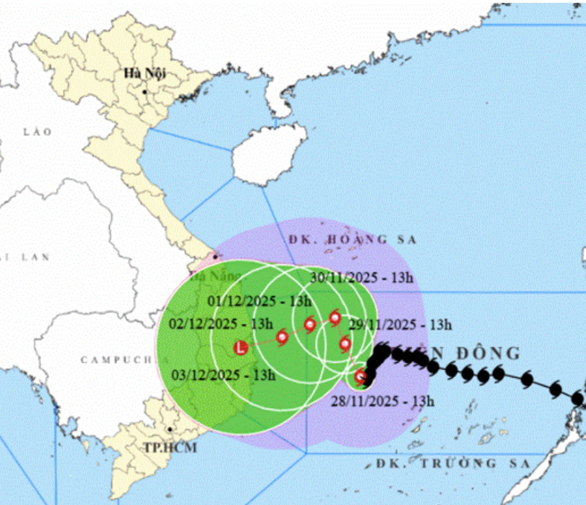 |
By 1:00 p.m. on November 30, the storm was positioned in the northwestern waters of the central East Sea, about 280 km east of Gia Lai Province’s eastern coast, with winds at level 9 and gusts up to level 12. On December 1 at 1:00 p.m., it is located about 200 km east of Gia Lai’s coast, with winds at levels 8–9 and gusts up to level 12.
The storm is generating strong winds of levels 7–9, with gusts up to 12–13, and waves reaching 3–5 meters across the northern waters of the Spratly Archipelago, causing a very rough sea. Offshore Khanh Hoa Province, winds are at levels 6–7, gusting to 9–10 and rough sea conditions with waves 4–6 meters high.
C.D
Translated by N.T


Thông tin bạn đọc
Đóng Lưu thông tin