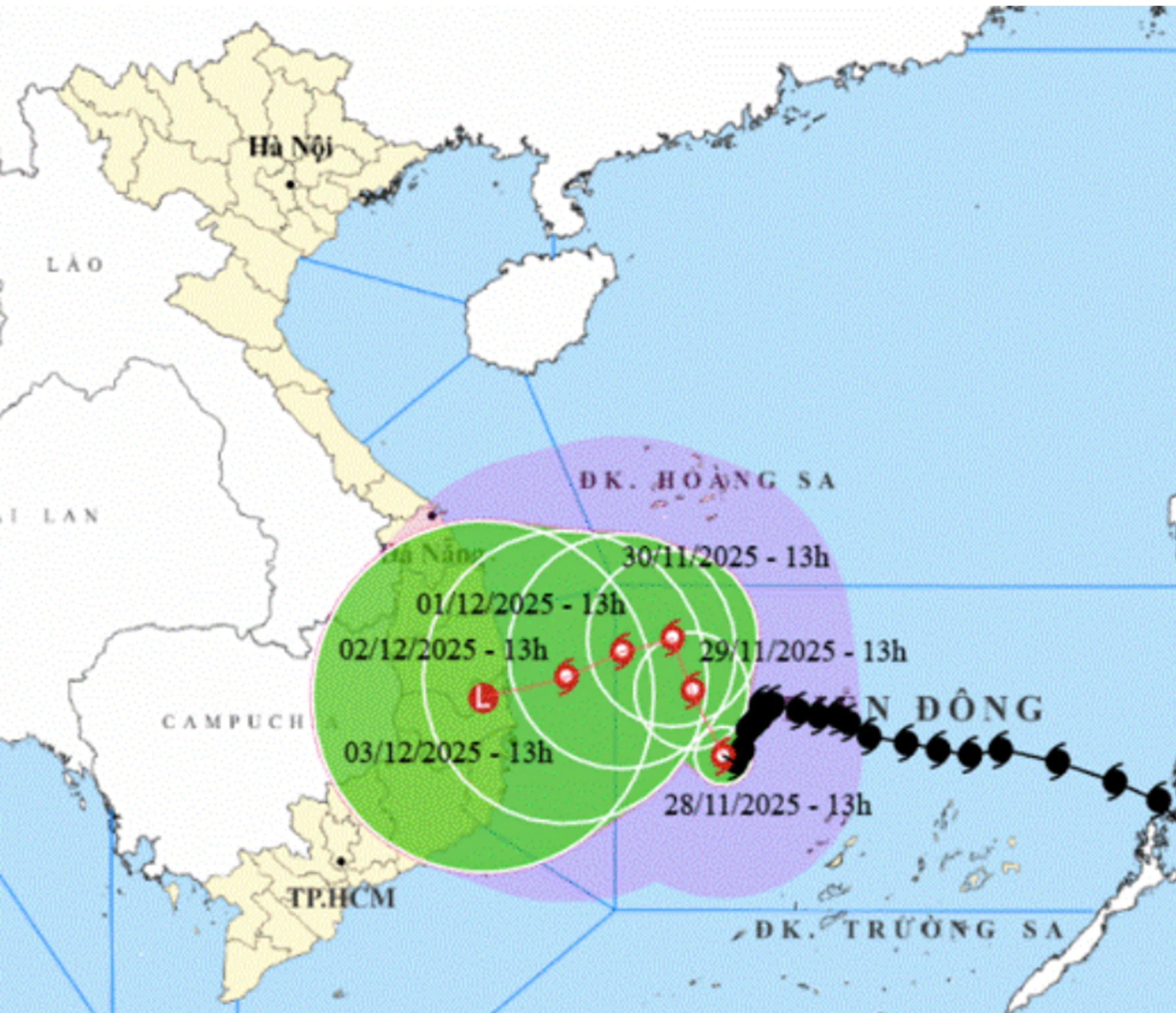
According to Khanh Hoa Provincial Hydrometeorological Station, at 4 a.m. on November 29, Storm No. 15 (Koto) was located about 310 km northwest of Song Tu Tay Island. The strongest winds near the storm’s center reached levels 9–10, with gusts up to level 13, moving in a north-northwest direction.
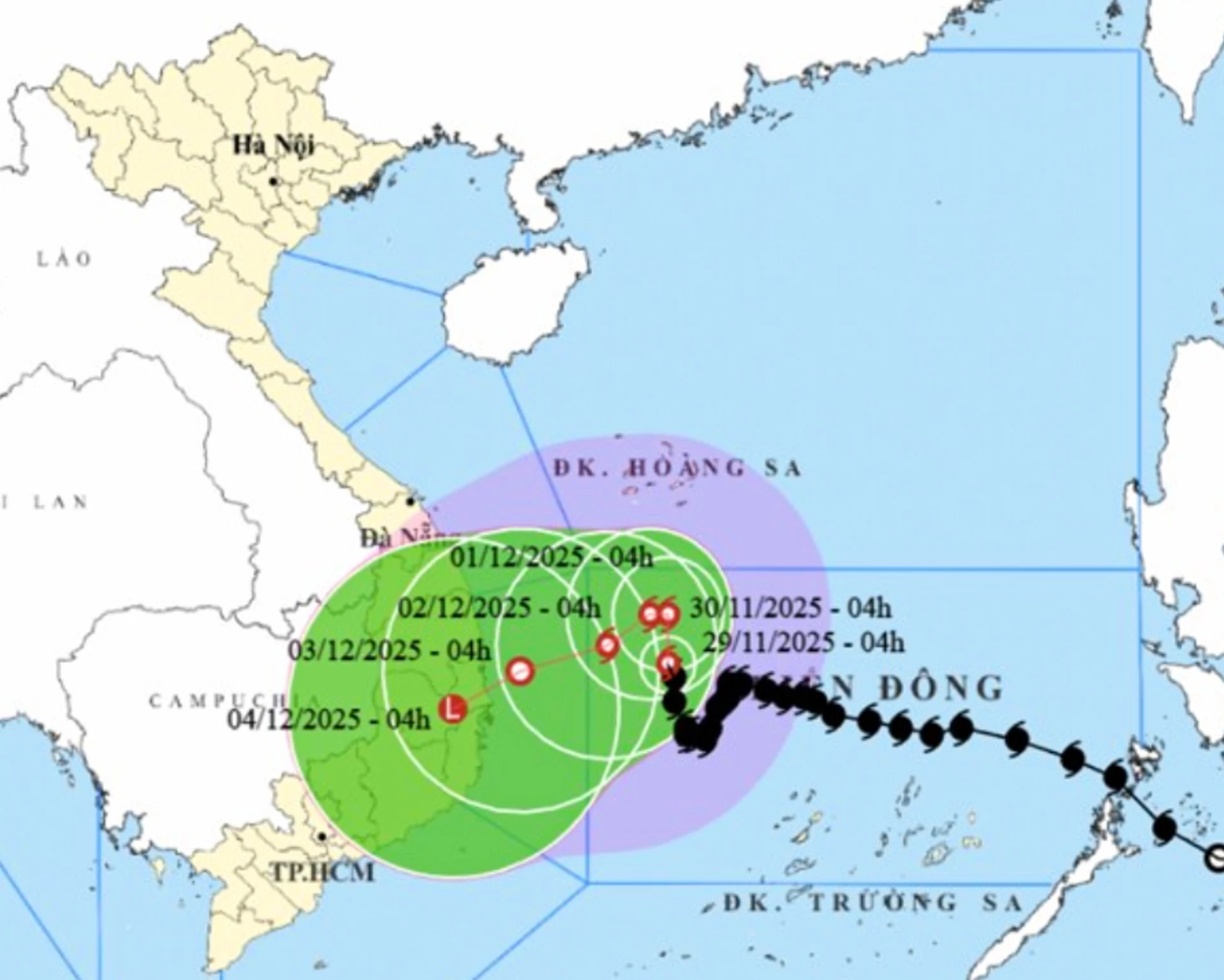 |
Forecasts indicate that by 4 a.m. on November 30, the storm will be in the northwestern waters of the central East Sea, about 330 km east of the coast of Gia Lai–Dak Lak provinces, maintaining wind speeds of level 9–10, gusting to level 13. By 4 a.m. on December 1, it is expected to remain in the same area, about 300 km east of the coast, with winds at level 9 and gusts up to level 12. By 4 a.m. on December 2, the storm will weaken further, located about 230 km east of the coast, with winds at level 8–9 and gusts up to level 12.
Due to the storm’s influence, the northern sea area of the Truong Sa special economic zone will experience strong winds of level 7–9; areas near the storm center may see winds at level 10, gusting to levels 12–13, with very rough sea conditions. Offshore waters of Khanh Hoa Province will have winds at level 6–7, gradually increasing to level 8, gusting to levels 9–10, with waves 4–6 meters high and rough sea conditions.
C.D
Translated by N.T


Thông tin bạn đọc
Đóng Lưu thông tin