According to the Khanh Hoa Provincial Hydrometeorological Station, at 7:00 a.m. on November 30, the center of Storm Koto was located in the northwestern waters of the central East Sea with the maximum sustained winds near the center reaching level 9 (75–88 km/h), gusts up to level 11. The storm is moving slowly toward the north-northeast at about 3 km/h.
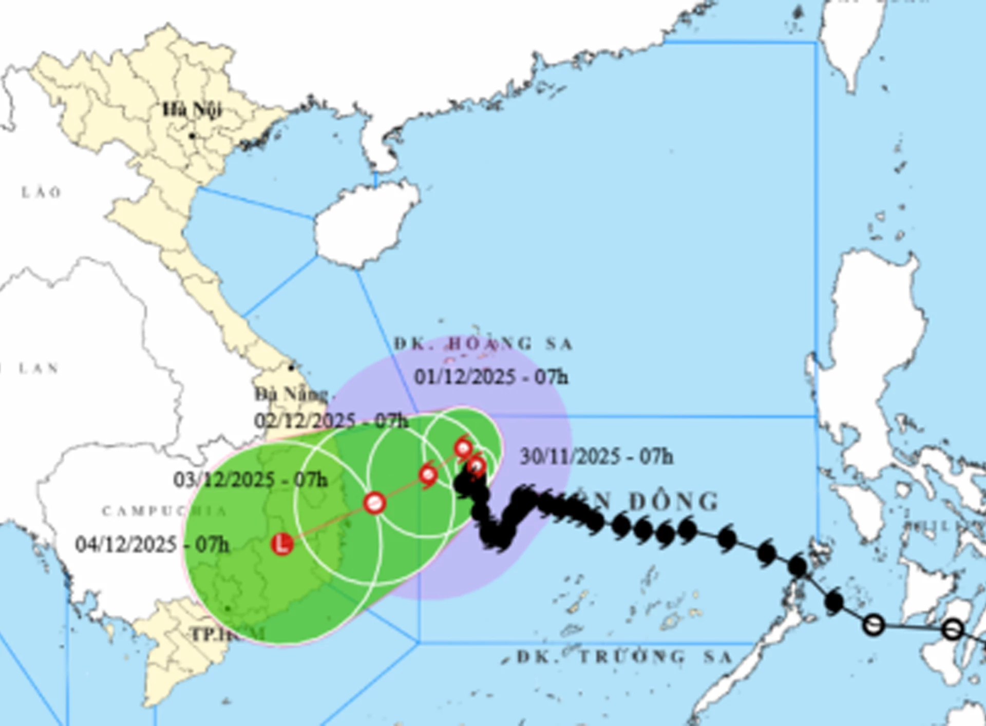 |
By 7:00 a.m. on December 1, the storm is forecast to remain in the same area, approximately 320 km east of the eastern coastline of Gia Lai–Dak Lak provinces, maintaining winds at level 9 with gusts up to level 11. On December 2, it is expected to be about 220 km east of Gia Lai– Dak Lak, weakening slightly to level 8 with gusts up to level 10. By December 3, the storm will approach the coastal waters from Gia Lai to Khanh Hoa, with winds reduced to level 6, gusting to level 8, and will continue to weaken into a tropical depression.
Over the following 72 to 96 hours, the tropical depression is likely to move west-southwest at about 10 km/h and weaken further.
Due to the storm’s influence, the northwestern part of the central East Sea will experience strong winds at level 7. Areas near the storm’s center may see winds at level 8–9, gusting to level 11, with waves 3–5 meters high and up to 7 meters near the center, resulting in a very rough sea conditions.
C.D
Translated by N.T


Thông tin bạn đọc
Đóng Lưu thông tin