According to Khanh Hoa Provincial Hydrometeorological Station, at 7:00 a.m. on December 1, the storm’s eye was located in this region with maximum sustained winds at level 8 (62–74 km/h) and gusts reaching level 10, while waves near the center rose as high as 3–5 meters.
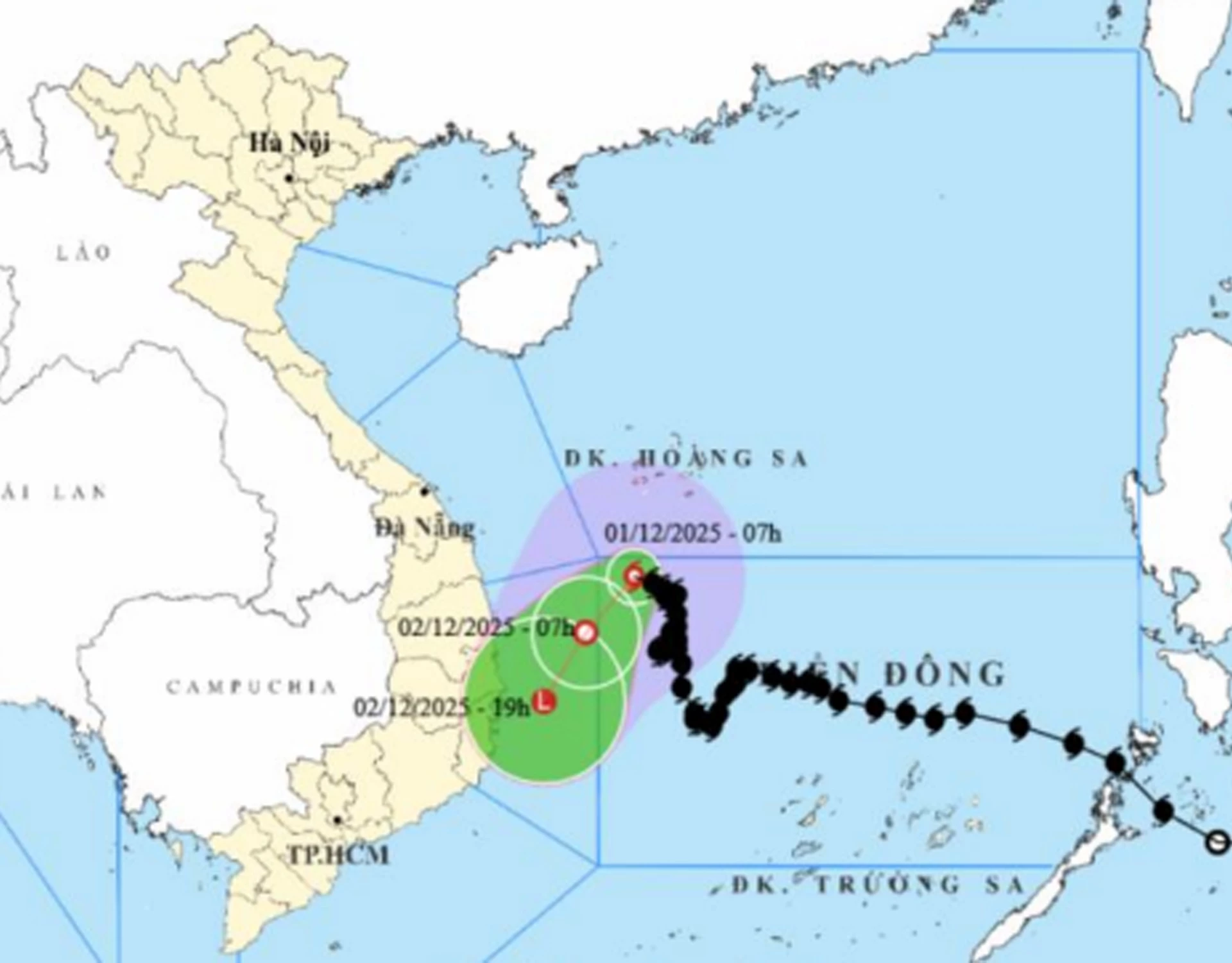 |
Forecasts indicate that by 7:00 a.m. on December 2, the storm will remain in the northwest East Sea, about 170 kilometers east of the Gia Lai–Dak Lak coast with winds weakening to level 6 and gusts to level 8.
By 7:00 p.m. the same day, the storm is expected to move into the coast from Gia Lai to Khanh Hoa and further weaken into a low-pressure zone.
Due its influence, the northwest sea area in the central East Sea will continue to experience strong winds of level 6; the area near the storm's eye is expected to be with strong winds of level 7-8, gusting to level 10; waves 2-4m high, the area near the storm's eye 3-5m in rough sea conditions.
On December 1, the seawaters of Khanh Hoa province are expected to experience winds at levels 6–7, with gusts reaching levels 8–9, creating rough sea conditions. Scattered showers and thunderstorm rain will occur throughout the day and night, with warnings issued for possible tornadoes and strong gusts. On December 2, strong wind will persist from the north to northwest at levels 6–7, gusting to levels 8–9, maintaining the rough sea.
C.D
Translated by N.T


Thông tin bạn đọc
Đóng Lưu thông tin