According to Khanh Hoa Provincial Meteorological and Hydrological Station, at 4 a.m on November 6, Typhoon Kalmaegi was about 450 km east-southeast of Quy Nhon, with winds reaching level 14 (150–166 km/h), gusting to level 17. It’s moving west-northwest at 30 km/h and is expected to approach within 120 km of Quy Nhon by late afternoon. The Typhoon poses a high disaster risk (level 4) to the coast from Quang Ngai to Dak Lak (including Ly Son island); the eastern mainland from Quang Ngai to Gia Lai; risk level 3 to the coast from southern Quang Tri to Da Nang City (including Cu Lao Cham island) and Khanh Hoa; the mainland from southern Quang Tri to Da Nang City, the western Quang Ngai and Gia Lai provinces, the eastern Dak Lak Province and the northern Khanh Hoa Province.
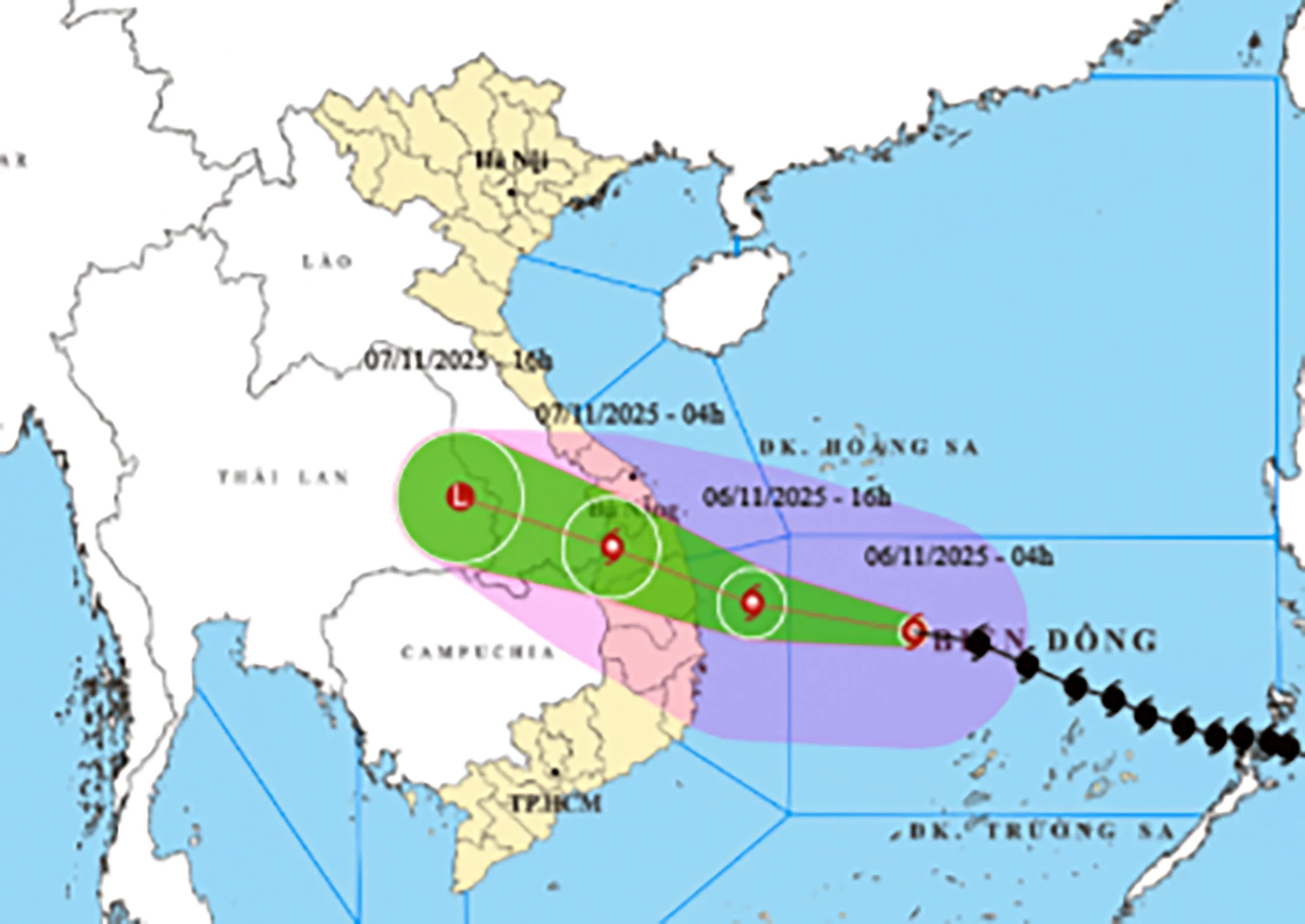 |
| Tracking Typhoon Kalmaegi. |
From November 6–7, strong winds and heavy rain will affect central Vietnam. Inland areas from Da Nang to Dak Lak may see winds up to level 12, with gusts to level 15. Rainfall could reach 200–400 mm, with some places exceeding 600 mm. Coastal areas face waves up to 10 meters and storm surges of 0.4–0.8 meters, risking flooding and landslides. The areas from southern Quang Tri Province to Hue City, Khanh Hoa and Lam Dong Provinces are forecast to experience torrential rain and some areas even with 450mm of rainfall.
In Khanh Hoa Province, winds will are forecast to intensify from the evening of November 6, especially in the north, with gusts up to level 11 and rainfall between 100–250 mm. Offshore and island regions, including the Spratly Islands, will experience severe rough sea conditions. From November 6 to the end of November 7, torrential rain is expected in Khanh Hoa Province, especially in the north. Residents are urged to stay alert for flash floods, landslides and raging winds.
H.D
Translated by N.T


Thông tin bạn đọc
Đóng Lưu thông tin